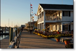
By then, the new old Beaufort was fully entrenched.
At the time real estate in Beaufort was selling so quickly that most desirable properties sold before you could respond to an email.
That first summer it did not occur to us to ask how Beaufort got the way it is today. Being mere tourists, we assumed that it must have always been like it is now. It was only later that we discovered that Beaufort's downtown and historic district had once been something far different than today's beautifully restored white wooden homes and quaint shops.
Our first hints of Beaufort's past came on water tours of the area when we saw the island where whales were processed. Later in another tour we got a glimpse of the menhaden processing plant which had brought money to so many over the years.
On that August 2003 trip we also saw ponies on Carrot Island and later heard about dredging spoils being used to augment the islands and help protect Beaufort from hurricanes. As we saw Beaufort's drawbridge in operation, it became clear that Beaufort's isolation and location might have something to do with its preservation.
Beaufort almost seemed to be an island cut off from the modern world, tucked in among marshes and hidden behind barrier islands.
One of the boat captains told me that until Duke Marine Lab experienced increased activity that required more housing, Beaufort was mostly old fish houses and homes in need of repair.
The transformation from fishing village to a cute historic village did not happen for a single reason or because of just one person.
It turns out Beaufort's renewal was influenced by geography, weather, a changing fishery and local people determined to hold on to some of their heritage. All the elements working unknowingly together gave us the Beaufort we love to visit today.
Geographically Beaufort was isolated for many years. It was on a peninsula surrounded by marshes. It had no large river to provide access to the interior of North Carolina. That kept the town small and prevented large scale shipping facilities from taking root in earlier times. The result was that through much of its history Beaufort remained a fishing village.
Eventually Beaufort got a bridge and even the rail road. Still even the railroad bridge couldn't endure the hurricanes that changed Beaufort's future.
Back to back hurricanes in the fifties that damaged the downtown area may well have started the rebirth of Beaufort. After being submerged a couple of times, many of the businesses left. There might have been some other economic reasons for their departure as well. Towards the end of the twentieth century the menhaden fishery started to decline along with other commercial fishing.
Another big change in Beaufort after the hurricanes was the relocation of Route 70 from Ann Street to farther away from the waterfront and historic homes.
Dr. John Costlow, who held positions as mayor of Beaufort, director of Duke Marine Research Lab, and president of the Beaufort Historical Association speculated on the impact of the moving of the drawbridge and Route 70 in the book, Beaufort-by-The-Sea, by Rick and Marcie Carroll.
"Had the bridge and entry remained on Ann Street and eventually widened to four busy lanes, much of the historic character of the third oldest town in North Carolina would have been ruined forever."
While relocation of the bridge and highway protected the historic downtown, there is little doubt that Beaufort's attraction over the years as a place for second homes where summer weary North Carolinians could enjoy a sea breeze played a significant part in the renovation of many homes along Front Street.
An urban renewal grant along with the formation of the Beaufort Historical Association in the sixties brought a different focus for the historic parts of Beaufort. Historic homes became sought after because of their history instead of the land they occupied.
Beaufort also became popular with people who had significant financial resources. The beautiful deep water along Taylor's Creek in Beaufort seemed to provide a perfect spot for sailboats using the Intracoastal Waterway. The newly built boardwalk along the docks only added to the attraction that the town's waterfront had for recreational boaters and tourists.
Instead of supplying fishing boats, Beaufort learned how to supply tourists with restaurants, shops, entertainment, and places to spend the night. The relocation of the Maritime Museum certainly helped as did the efforts of many citizens determined that Beaufort would remain true to its historical character.
The commercial fishermen no longer tie up along Front Street, and many of Beaufort's home owners are from far away with some houses unoccupied for much of the year. Still the town has been taking care of visitors for most of its history, and that is what it is doing now.
The cooling breezes that come off the Atlantic have been bringing those visitors and new inhabitants to Beaufort for hundreds of years and will likely continue to do so for many years to come.
It is lucky for us who enjoy the town that those breezes and the handsome white homes haven't changed all that much over the years in spite of the huge changes in the world around us.
You can view pictures of Beaufort at this Picasa Web Album. They were taken during an afternoon visit to Beaufort in November 2008.
This article was originally published in Dropping Anchor.
David Sobotta, the author is a Realtor®, Writer, Photographer, and Fisherman who enjoys regular visits to Beaufort from his home near the White Oak River in western Carteret County.